Date – December 2, 2012
Location – Map 17, Albion Hills, to Map 18,
Hockley Valley
Distance – 16.4 km
Total Trail Distance – 361.3 (532.7 to go)
Hikers – Steve, Simon, Dean, Marlene, Benjamin,
Harold, Janette, Madeleine and Graham
Start – 34.5 Finnerty Sideroad, Caledon
Hills Section
End – 50.9 Airport Road
Direction – North
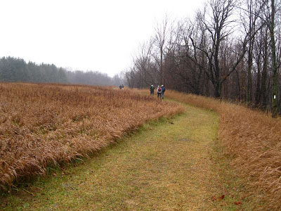
Weather – Dreadful. Pouring rain.
Dean's co-worker, Carol, had planned to
join us, but the dismal forecast drives her away. We must be real hikers
because no one in their right mind would head out on a day like this.
It rains almost the whole time, but weirdly,
we enjoy it. I wait at a stream crossing with the camera, in hopes that Harold
will repeat the splash he reports from a previous hike, but he makes it across
safely. We are grateful for the bridges and boardwalks that keep us out of some
water, but we are all soaked and muddy nevertheless.
We stop for lunch, perched on some concrete bridge abutments, and later, Simon and Ben find an abandoned car at the base of a small cliff and enjoy lobbing rocks at it and taking swipes at it with their sticks.
We meet up with the beginning of the Oak
Ridges Moraine Trail, which stretches 160 kilometres to the east. Hmm --
something to consider when we're done the Bruce Trail?
We find a gazebo which provides a welcome place for a rest stop.
And we also find this encouraging message
posted on the Oak Ridges Moraine rain-soaked interpretive sign:
• Hiking is one of the healthiest lifestyle choices that a person can
make.
• Hike Ontario has identified many health-related benefits including weight
loss, prevention of heart disease, lower blood pressure, improved mental health,
reduced stress and slowing of the aging process.
• As little as half an hour of brisk walking a day can show tangible
improvements to a person's health.
Indeed. Walk on!
We end our hike back at Harold and
Janette's house, where we are joined by Jenny, Elza and Robyn for a Christmas
potluck dinner. Good food, good drink and good company.
Here's to many more hikes in the years
ahead.


