Hike
#57
Date – April 19, 2015
Location – Maps 32 Inglis Falls and 33 Owen Sound West
Distance – 16.3
Total Trail Distance – 785.5 (108.5 to go)
Hikers – Dean, Marlene, Benjamin, Steve, Simon, Jacob, Harold, Janette and Madeleine
Start – 91.4 Grey Sauble Conservation Authority Headquarters
End – 107.7 Somers Street
Direction – North
Weather – Spring day, bright and cool – but warm when you’re hiking
This is day two of our spring hiking
weekend and it’s another one of those hikes which makes it obvious why this is
such a worthwhile endeavour. Sorting through the pictures (I took 475 of them!)
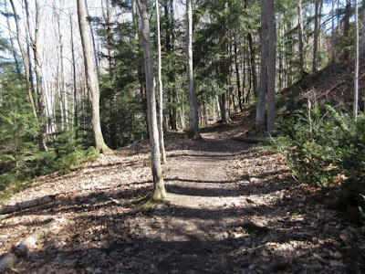
there is so much that is typical escarpment – the trees, crevices, rocks and
views – and it is beautiful and humbling and we still never tire of it.
Another good thing is that Madeleine is
able to join us, driving up Sunday morning after a wedding.
As if hiking 16 kilometres wasn’t enough
of a workout, just after Inglis Falls, Ben challenges Simon and Jacob to a race
up a grass-covered hill, and then they slide back down on their butts.
Near the end, a sign warns that a stream
bed (Maxwell Creek) might be difficult to cross in the spring because of high
water, but it’s completely dry, so we spend some time enjoying the massive
rocks, and the trees that have managed to grow on the barren ground.
At Highway 21, we have to descend a
steep wooden ladder to cross the road, and we are plunged into winter, greeted
by a blanket of deep snow.
I sorted the 475 photos down to 130, but
that’s still too many, so here are a few. Really, you should go and hike it
yourself.


No comments:
Post a Comment